

SOLUTION BRIEF | ENERGY
Find subsurface data by well, field, and operator.
Subsurface Info adds SEG-Y, LAS, and DLIS header fields to your Diskover index, so every file in the enriched metadata catalog carries its well, field, and survey details.
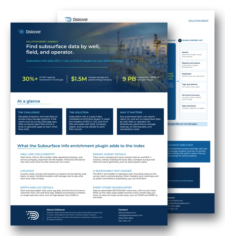
30%+
of HPC capacity reclaimed in oil and gas
$1.5M
storage savings at a global energy company
9 PB
indexed for a $60B oil and gas merger
At a glance.
The challenge.
Decades of seismic and well data sit across many storage systems. A file name such as survey_002.segy says little, so teams open files one at a time in specialist apps to learn what they hold.
The solution.
Subsurface Info is a post-index metadata enrichment plugin. It reads the headers of SEG-Y, LAS, and DLIS files and adds well, field, company, depth, and survey details to each file’s record.
Why it matters.
Any authorized team can search, report on, and act on subsurface data by well, field, or operator: for divestitures, governance, storage cleanup, AI training data, and visualization tools.
What the plugin adds to the index.
Well and field identity.
Well name, UWI or API number, field, operating company, and service company, read from the file header. Find every file tied to one well, even when the file names do not match.
Seismic survey details.
Trace count, samples per trace, sample interval, and SEG-Y revision, without loading the trace data. Compare surveys that share the same geometry, such as reprocessed copies.
Location.
Country, state, county, and location, so reports can be split by area, basin, or asset. Combine location with storage cost to see what each area costs to keep.
A searchable text header.
The SEG-Y text header is indexed as text, including notes on the survey, client, and processing. When headers carry markings such as export controlled or proprietary, you can find them.
Depth and log details.
Start and stop depth with units, log date, and the list of curves or channels, from LAS and DLIS logs. Depths are stored as numbers, so range searches work, such as logs deeper than 3,000 m.
Every other header entry.
Kept as searchable SECTION.KEY=value text, with no new index fields, so the index stays stable however many vendor keys you have. An alias list maps vendor keys, such as COMP and OPER, to one field.
Technical details.
Archive-safe
Files with nothing on disk, such as tape stubs, are skipped before any read. Nothing is recalled from tape.
Small reads
SEG-Y: first 3,600 bytes. LAS: header up to 1 MiB. DLIS: metadata only. Trace and curve data are never read.
Built for scale
Parallel workers, a time limit per file, and no repeat reads of unchanged files keep runs safe on large estates.
Clear status
Every file gets a status. Malformed files are tagged, so your team can find and fix them.
Formats: SEG-Y rev 0, 1, and 2, EBCDIC or ASCII, big- or little-endian, plus LAS 2.0 and DLIS well logs.
How it works.
1. Scan
STORAGE OR IT TEAM
Diskover scans NAS, object, cloud, and file shares, such as Dell PowerScale, NetApp, and Amazon S3, and indexes file metadata such as path, name, size, dates, and ownership.
Example: a basin project share is indexed where it sits.
2. Enrich
AUTOMATION
After the scan, Subsurface Info reads the header of each matching SEG-Y, LAS, and DLIS file and adds well, field, company, depth, and survey details to its record.
Example: a LAS log now shows its well name, UWI, field, and depth range.
3. Search
ANY AUTHORIZED TEAM
Query any header field with the Quick Search builder or Lucene syntax, run range searches on depth, and save searches for your team.
Example: a geoscientist saves “logs deeper than 3,000 m” as a search.
4. Act
BY POLICY
Schedule CSV reports, find duplicate surveys and logs, and tag, tier, archive, retain, or delete by policy. Send selected datasets to analytics and AI pipelines.
Result: an oil and gas company indexed 9 PB to prepare data for a $60B merger.
Use cases.
Divestitures and M&A.
Report by field or well, click a slice to list every file for that asset, then tag, export, move, or delete it. Hand over a complete, documented dataset. See M&A data.
Governance.
Find files with markings such as export controlled outside approved folders, for example in user working folders or site inboxes. Tag them and move them back to approved storage.
Cleanup and cost.
Find duplicate surveys and logs, see cost per storage location, and tier or archive data nobody has used in years. Bring fast storage back for active projects.
Questions people ask.
What does the Subsurface Info plugin do?
It is a post-index metadata enrichment plugin. After a Diskover scan, it reads the headers of SEG-Y, LAS, and DLIS files and adds well, field, company, depth, and survey details to each file’s record.
Does Subsurface Info read seismic traces or well log curves?
No. It reads headers only: the first 3,600 bytes of a SEG-Y file, the LAS header up to 1 MiB, and DLIS metadata. Trace and curve data are never read.
Is it safe on tape and archive tiers?
Yes. Files with nothing on disk, such as tape stubs, are skipped before any read, so nothing is recalled from tape. Unchanged files are not read again on later scans.
How do teams find every file for one well?
Search the well name or UWI field. Because the value comes from the file header, the search finds every file tied to that well, even when the file names do not match.
Can AI tools use the subsurface fields?
Yes. The REST API and the AI Connector expose the enriched records, so teams can ask Claude, ChatGPT, Gemini, or Copilot for reports in plain language. Any action the AI suggests waits for human approval.
Related resources.
See it on your own data.
We’ll index a sample of your environment and show you
what’s recoverable against your current storage spend.